مسار الطريق على الخريطة
Hung Hom Station
→
Airport (Ground Transportation Centre)
Hung Hom Station → Airport (Ground Transportation Centre)
Airport (Ground Transportation Centre) → Hung Hom Station
Service Directions
Hung Hom Station → Airport (Ground Transportation Centre)
Airport (Ground Transportation Centre) → Hung Hom Station
Operating dates and week days
Everyday
Whole year
Whole year
Timetable
05:15 - 22:15 every 15 min
مدينة:
Hong Kong
نوع وعدد النقل:
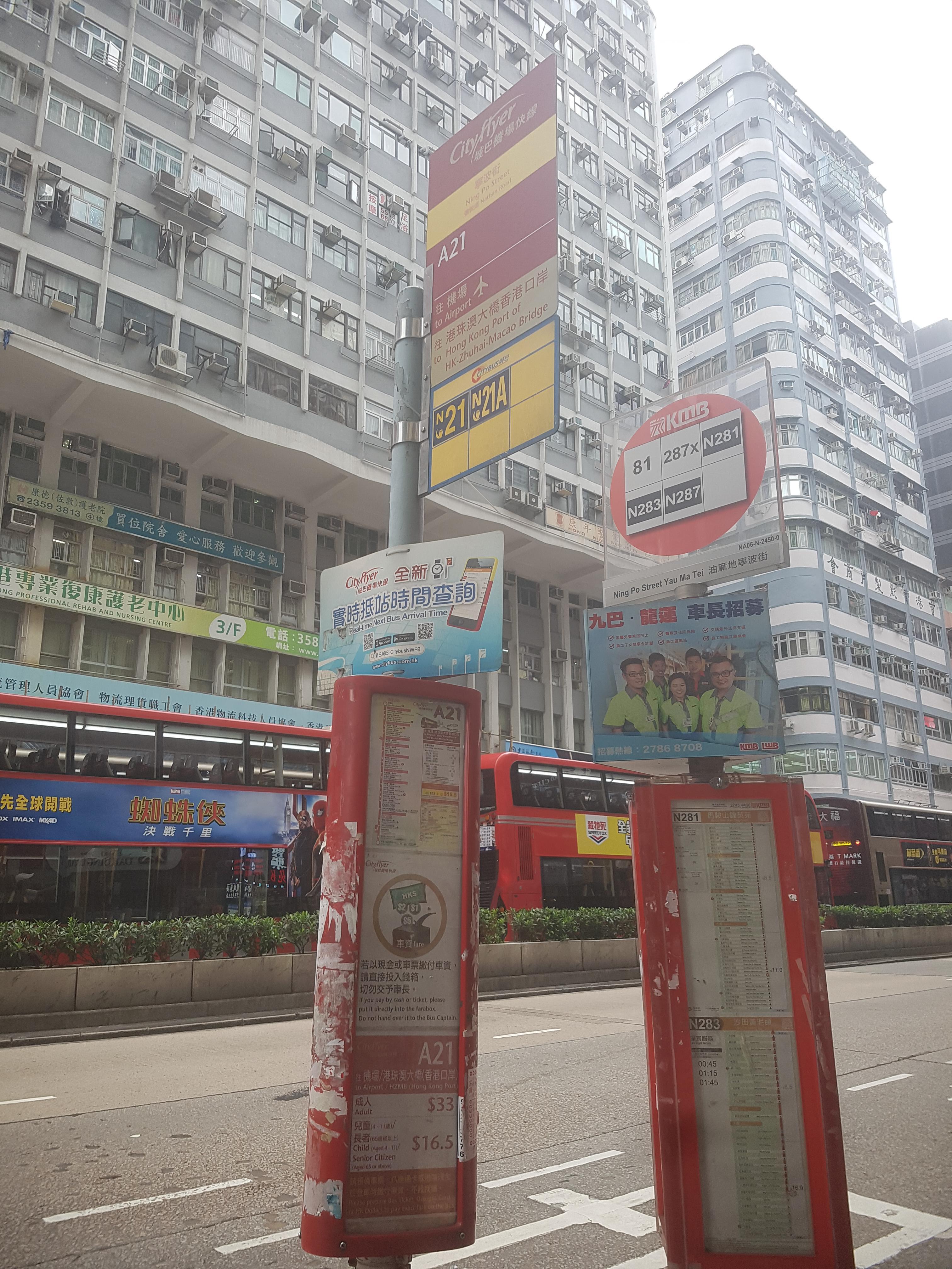
حافلة A21
أجرة:
33.0 HK$
يمر على الشوارع:
Hung Hom Station - Airport (Ground Transportation Centre)
وكالة العبور:
Citybus
معلومات اضافية:
Cityflyer route.
إحصاءات الطريق:
The length of the trip line №1: 44.17 كم
مناطق التوقف: 24
مناطق التوقف: 24
The length of the trip line №2: 36.49 كم
مناطق التوقف: 20
مناطق التوقف: 20
آخر تعديل :
عدل هذا الطريقهل وجدت خطأ؟ يرجى تصحيحه في دقيقتين.
مناطق التوقف: Hung Hom Station → Airport (Ground Transportation Centre)
Hung Hom Station Hong Kong Science Museum, Chatham Road South Mody Road, Chatham Road South East Tsim Sha Tsui Station Haiphong Road, Nathan Road Kimberley Road, Nathan Road Tsim Sha Tsui Police Station, Nathan Road Ning Po Street, Nathan Road Public Square Street, Nathan Road Pitt Street, Nathan Road Changsha Street, Nathan Road Grand Tower, Nathan Road Mong Kok Market, Argyle Street Ming Kei College, Cherry Street The Long Beach, Hoi Fai Road Chui Yu Road, Sham Mong Road Nam Cheong Estate, Sham Mong Road Fu Cheong Estate, Sham Mong Road Tonkin Street West, Sham Mong Road Hoi Lai Estate, Sham Mong Road Lantau Link Bus-Bus Interchange Airport (Terminal One) HZM Bridge Port Passenger Clearance Building Airport (Ground Transportation Centre)
مناطق التوقف: Airport (Ground Transportation Centre) → Hung Hom Station
Airport (Ground Transportation Centre) Hong Kong-Zhuhai-Macao Bridge Hong Kong Port Public Transport Interchange Lantau Link Bus-Bus Interchange AquaMarine, Sham Mong Road Fat Tseung Street West, Sham Mong Road Metropark Hotel Mongkok, Lai Chi Kok Road Mong Kok Station Bank Centre, Nathan Road Sino Centre, Nathan Road Man Ming Lane, Nathan Road Nathan Hotel, Nathan Road Tak Shing Street Kimberley Road, Nathan Road Cameron Road, Nathan Road Middle Road, Nathan Road East Tsim Sha Tsui Station, Salisbury Road Mody Road, Chatham Road South Granville Road, Chatham Road South Hong Kong Science Museum, Chatham Road South Hung Hom Station